The British Empire, once spanning continents and seas, remains one of the most expansive and influential empires in world history. From the humble beginnings of overseas trading posts to the zenith of global dominance, the British Empire Map left an indelible mark on cultures, economies, and geopolitics around the world. At its peak, the sun never set on the British Empire, a testament to its vast reach across continents and oceans.
Understanding the British Empire Through Maps
Maps have always been powerful tools for understanding and visualizing the extent of empires. For the British Empire, maps serve not only as geographical records but also as artifacts that tell stories of conquest, trade, migration, and cultural exchange. They provide insights into the evolution of the empire, from early explorations and colonies to the eventual decline and legacy.
Exploring the British Empire on a Map
Early Expansion and Exploration
The British Empire began its journey with explorers and traders venturing into uncharted territories. Maps from this era show the discovery of new lands and the establishment of trading posts, such as those in North America and India. These maps often reflect the Eurocentric perspective of the time, marking territories claimed by British explorers and merchants.
Colonial Expansion
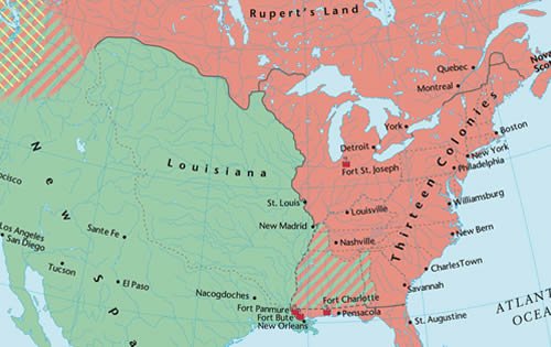
As colonial ambitions grew, so did the British Empire. Maps from the 17th to 19th centuries illustrate the expansion across the Americas, Africa, Asia, and Oceania. They highlight the establishment of colonies, strategic ports, and trade routes that connected distant corners of the world to the British Crown. These maps also reveal the complexities of colonial administration and the diverse landscapes under British rule.
Peak of Imperial Power
By the 19th century, the British Empire reached its zenith, encompassing nearly a quarter of the world’s landmass and population. Maps from this period, such as those from the Victorian era, depict a global empire with dominions, protectorates, and spheres of influence spanning from Canada to Australia, from South Africa to Hong Kong. These maps underscore Britain’s role as a global superpower and its influence on international affairs.
Maps of Influence and Legacy
Beyond territorial expansion, maps of the British Empire also reveal cultural exchanges, scientific explorations, and the spread of ideas. They document the mapping of natural resources, the development of infrastructure such as railways and telegraphs, and the integration of local economies into global trade networks. These maps are crucial in understanding the lasting impact of British colonialism on the world stage.
The British Empire Flag Map
The Union Jack, with its iconic combination of crosses representing England, Scotland, and Ireland, became synonymous with the British Empire. A British Empire flag map visually represents the territories under British sovereignty, often incorporating the Union Jack alongside colonial flags or symbols denoting imperial possessions. These maps serve as symbols of pride, identity, and authority during the height of imperial expansion.
Mapping the Legacy Today
While the formal dissolution of the British Empire occurred in the mid-20th century, its legacy continues to shape global politics, economies, and cultures. Maps of former British territories today reflect the diverse outcomes of decolonization, from independent nations to territories with ongoing disputes over sovereignty. They also highlight the enduring connections forged during the era of British rule, including language, legal systems, and cultural practices.
The Role of Maps in Historical Understanding
In the digital age, access to historical maps of the British Empire has expanded, offering scholars, enthusiasts, and the general public opportunities to explore and analyze imperial history. Websites and archives like the Map Archive provide a wealth of resources, including digitized maps, interactive timelines, and educational materials that contextualize the rise and fall of the British Empire within broader global narratives.
Conclusion
Mapping the British Empire is not merely an exercise in geography but a journey through centuries of history, politics, and human experience. From the early days of exploration to the complexities of colonial administration and the enduring legacies of decolonization, maps offer insights into the evolving nature of empire and its impact on the world. As we navigate the complexities of a globalized world, understanding the British Empire through maps remains essential in comprehending the forces that have shaped our modern geopolitical landscape.
Whether exploring the biggest British Empire map or examining detailed flag maps, each cartographic representation tells a unique story of ambition, conquest, and the lasting imprint of one of history’s most influential empires. As we reflect on the British Empire through maps, we gain a deeper appreciation for the interconnectedness of nations and the enduring quest for power and influence in human history.